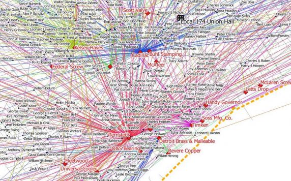
Event: "Putting Class on the Map: Towards a Labor Cartography"
Please join us June 1 at noon for a brown bag research discussion in the Reuther Conference Room.
From hand-sketched diagrams of plant layouts drawn up in hasty preparation for strikes, to diagrams of syndicalist visions of One Big Union, mapping has long been an important but overlooked part of labor organizing. Steve McFarland, Assistant Professor of Geography at the University of Tampa, will be at the Reuther Library in May and June doing research into maps created by workers organizations. His talk will discuss this work-in-progress, which puts forward working class perspectives on cartography and Geographic Information Systems (GIS) as a crucial aspect of "mapping from below." Drawing on work in labor geography by Andrew Herod, and in critical cartography by J.B. Harley, Steve's research engages with historical GIS and cartographic history in a way that foregrounds mapping of and by workers and working class organizations. In so doing, he offers a corrective to dominant currents in cartography that have elided workers, work, and class issues. He hopes that these archival excavations will inspire a new interest in contemporary uses of mapping and GIS in labor organizing.
Feel free to bring a lunch and your questions for Dr. McFarland. We hope to see you there!


 Reddit
 Facebook
 LinkedIn